![]()
Главная Карта сайта Фотоальбомы Подбор Открытки Приложения
Geography: processes and form [ In Russian ] 2017 Sections and summary of chapters of the Atlas (early version)
Let's do it together !
Title of sections and topics of the Atlas (with explanations and examples of geosites) |
View |
ZIP-file |
Size (Mb) |
||||||||
| Introduction | |||||||||||
| Concept of the data resource “Atlas of simple landforms of Mongolia” / RU / DE 2022 | |||||||||||
| Representative sites | 084,66 |
||||||||||
| Big Altai: Russian, Mongolian, Gobi, Kazakh (Southern), Dzungarian (Xinjiang) | 082,03 |
||||||||||
| Part 1. Endogenous processes and landforms |
|
||||||||||
| Tectonic shear deformations (seismic dislocations) New | 388,06 |
||||||||||
| Mongolian and Gobi Altai - Must, site Mayngan, Khovd, Bayan-Tsagaan, Bayanhongor | 353,89 |
||||||||||
Khangai Highlands - Tsavdan Nuur, Uvs |
|||||||||||
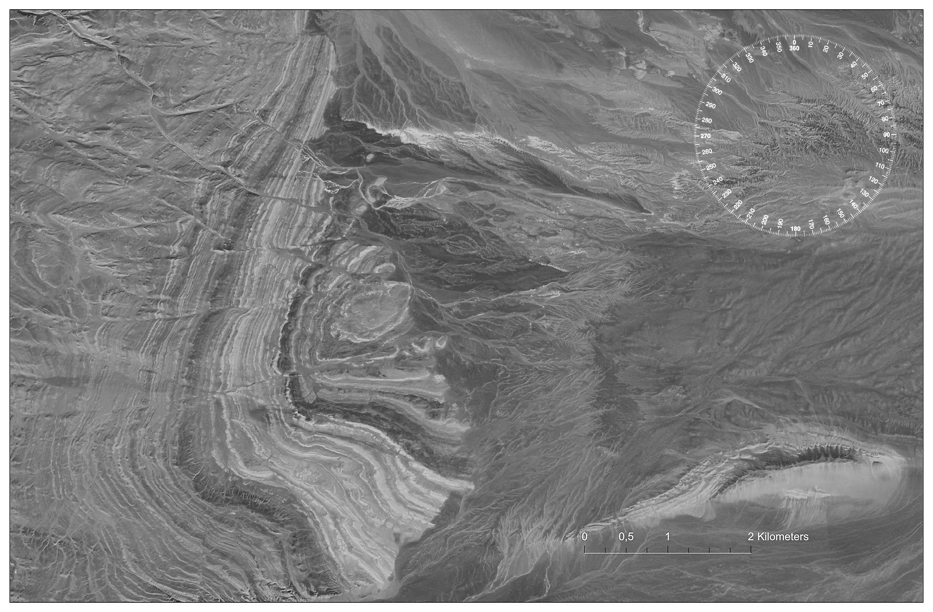
| Tectonic folded deformations (plastic deformations) | 138,31 |
||||||||||
| Mongolian and Gobi Altai - Khan-Khuchei nuruu, Uvs, Kholt, Umnegovi |
132,88 |
||||||||||
| Magmatic and volcanic structures (intrusive and effusive magmatism) | 128,30 |
||||||||||
| Gobi Altai - site east of Zaraa uul, Ovorkhangai, Noyon uul, Umnegovi | 097,15 |
||||||||||
| Part 2. Exogenous processes and landforms | |||||||||||
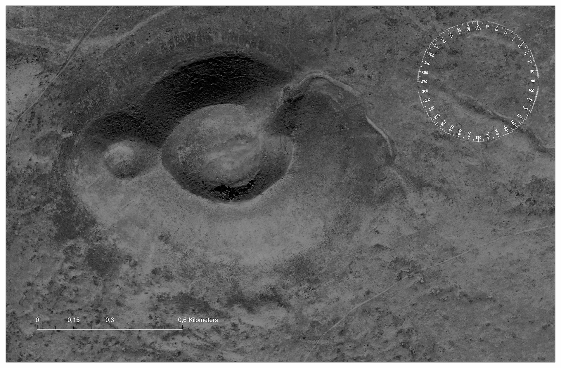
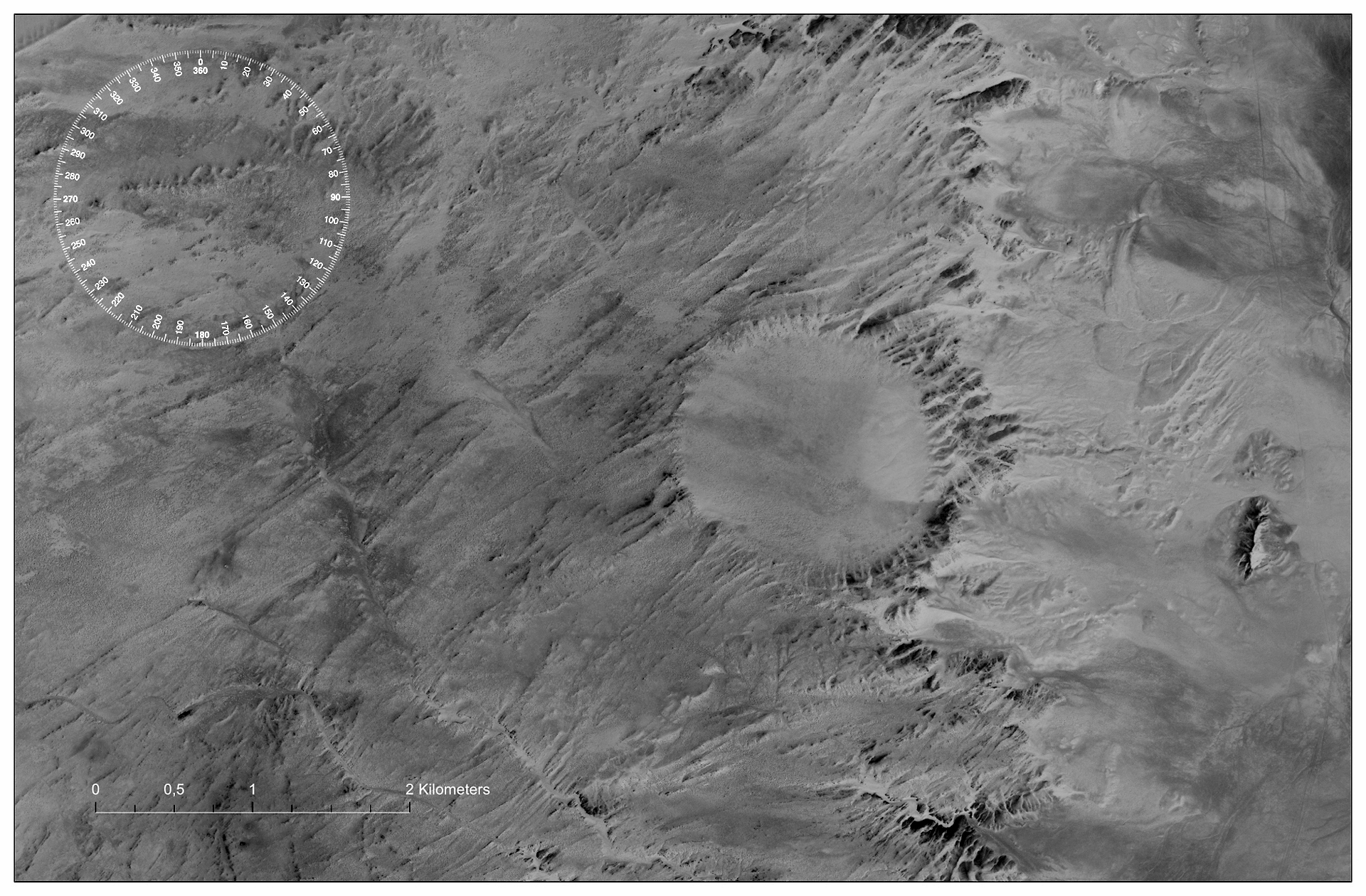
| Meteorite craters (astroblemes) New | 041,46 |
||||||||||
| Eastern or Mongolian Gobi (Gobi-Shamo) - Bayan-Khuri astroblemes - Uneg mine, Dornogovi |
037,92 |
||||||||||
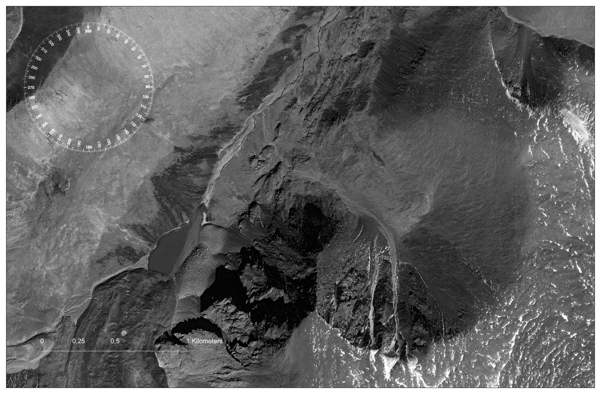
| Cryogenic landforms - glacial and permafrost landforms (snow, ice, water and terrain) | 170,97 |
||||||||||
| Mongolian Altai - Tsagaan gol, site Tsengel Khairkhan uul, Bayan-Ulgi | 158,74 |
||||||||||
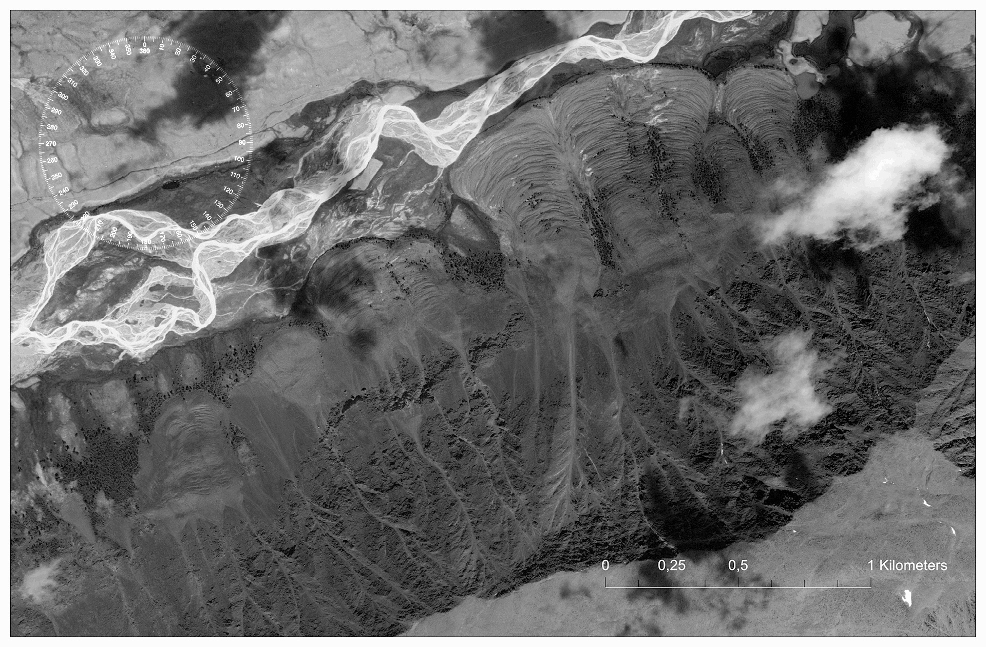
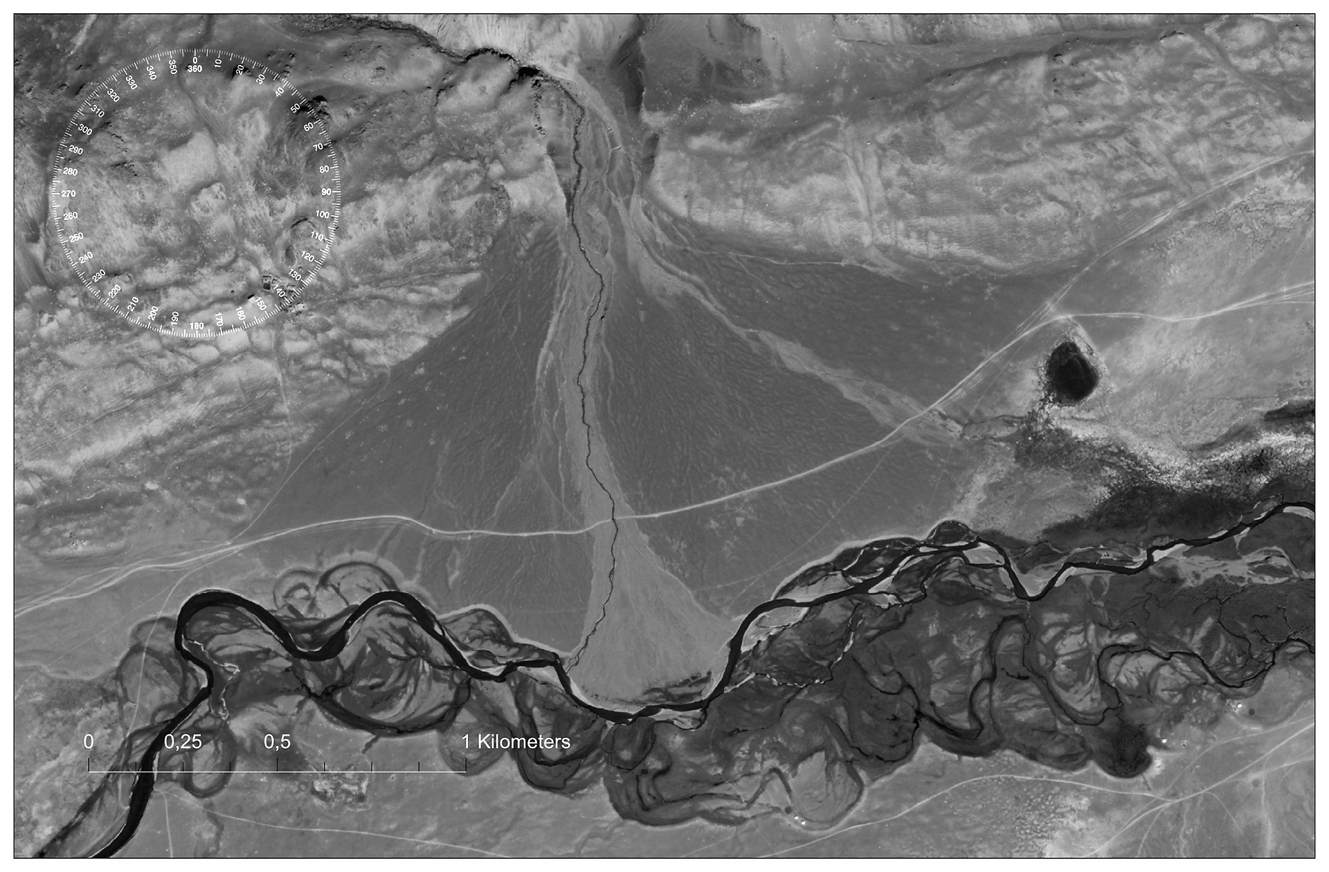
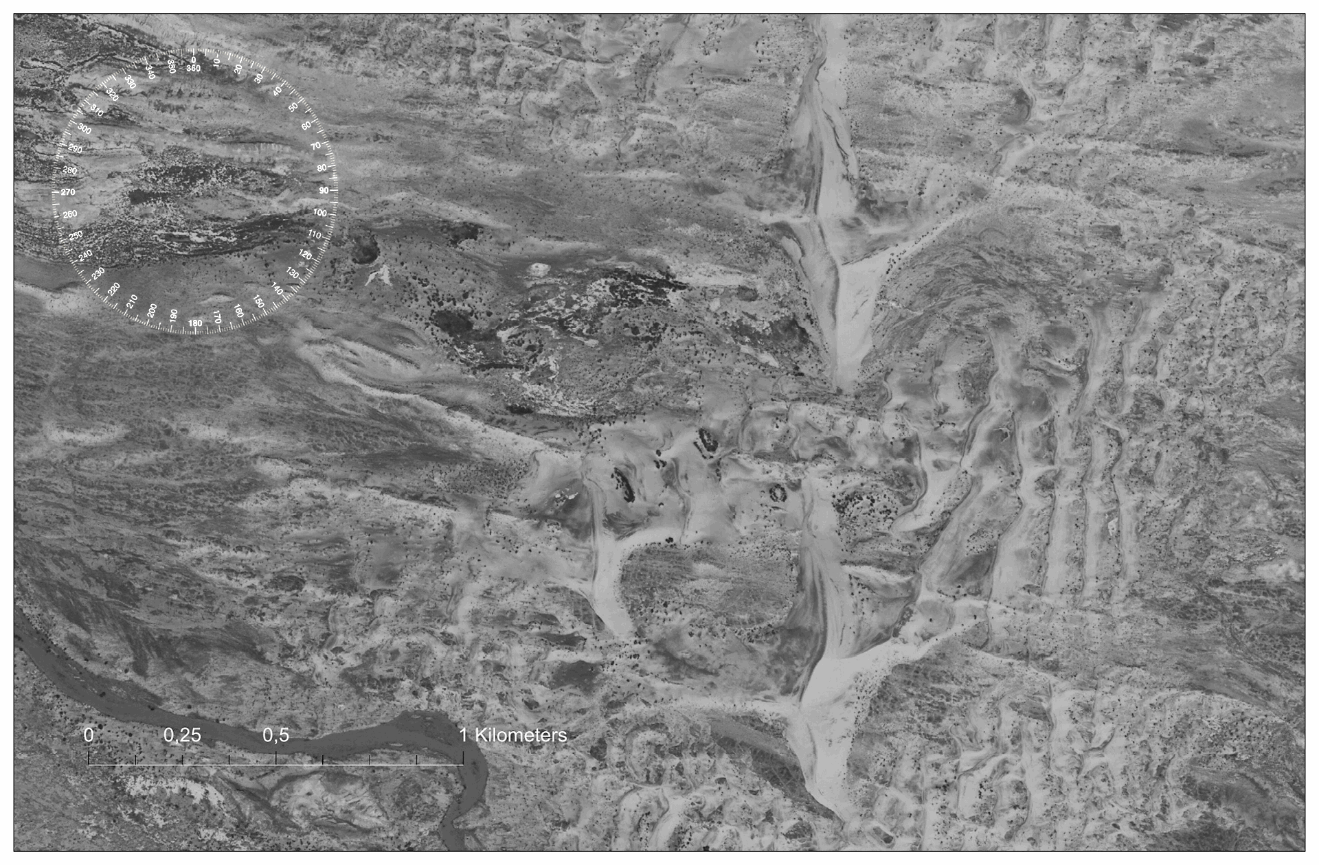
| Fluvial landforms (rivers and valleys, streams and lakes) | 281,34 |
||||||||||
| Mongolian Altai - Chigirtay vl., Tolbo Nuur Bayan-Ulgi, Basin of Uvs Lake - Tes (Tesiin gol), Nariin gol, Uvs | 258,03 |
||||||||||
| Basins of Great Lakes - Byant gol, Barun gol and Khovd gol (Kobdo) Khovd | |||||||||||
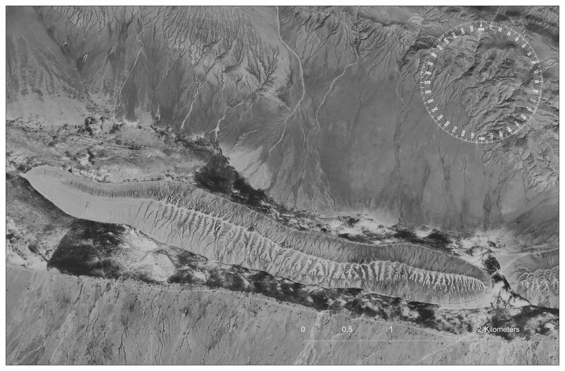
| Aeolian landforms (areas of sandy massifs) New | 222,67 |
||||||||||
| Khangai Highlands - site east of Khar Nuur, Zavchan, Eastern Gobi - Borzogiin Govi, Umnegovi | 210,59 |
||||||||||
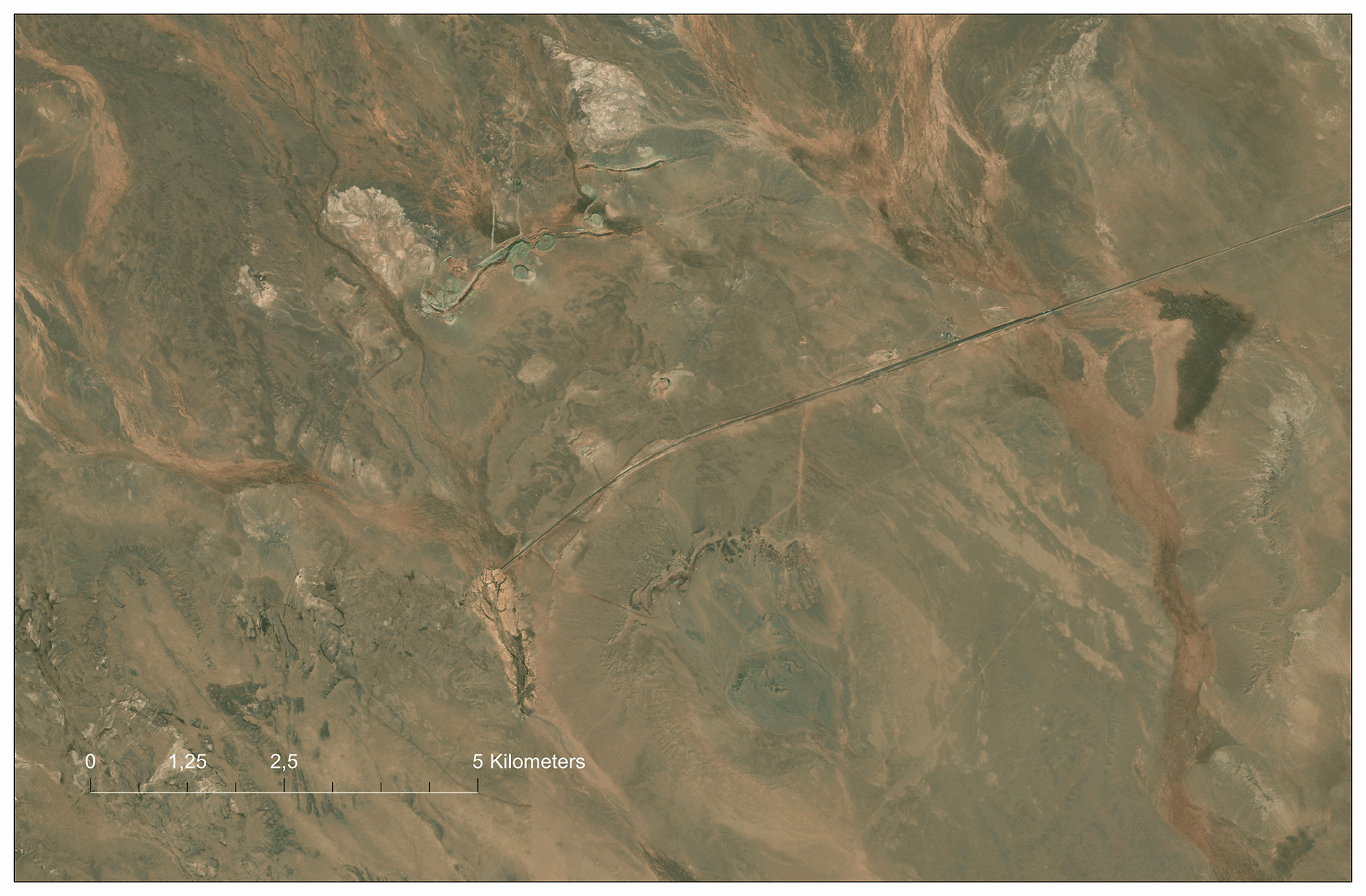
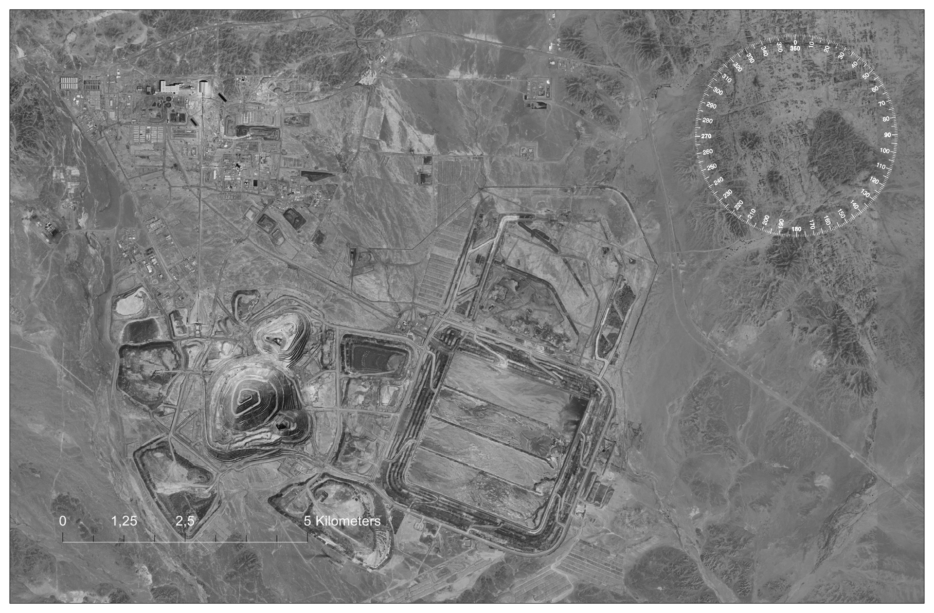
| Human and relief (technogenic forms) New | |||||||||||
| Eastern Gobi - site of an engineering structures - "Wall of Genghis Khan", mine: Oyu-Tolgol, Ali-Bayan, Umnegovi |
117,80 |
||||||||||
Khangai Highlands - Erdenet, Bulkan |
108,09 |
||||||||||
| Part 3. Relief and its visual representation | |||||||||||
| Visualization of data (DEMs and satellite images Landsat, Santinel...) | |||||||||||
A series of simple solutions and thematic illustrations |
Монголия. Открытая поверхность. geophotobank.com/open-mn / geo-edu.ru/open-mn © Абдульмянов С.Н. abdulmyanov@gmail.com